The Aswan High Dam is a 20 minute stop that explains everything else you see in Egypt
The Aswan High Dam is a 20 minute stop that explains everything else you see in Egypt
The Aswan High Dam is the rock and sand embankment that closed the Nile just south of Aswan between 1960 and 1970, built with Soviet money and engineers after Western financing fell through. It ended the annual flood that had governed Egypt for five thousand years, created Lake Nasser, one of the largest reservoirs on earth, and forced the UNESCO campaign that moved Abu Simbel and Philae to higher ground. The visit is short: you drive the crest road, stop at the lotus shaped friendship monument, look south over the lake and north down the river toward the older British dam, and you are back in the car within half an hour. It sits naturally between the Unfinished Obelisk and Philae on any Aswan morning.
What the Aswan High Dam is, in plain terms
Most visitors expect a wall. The High Dam is not a concrete arch like Hoover Dam. It is an embankment dam, a man made ridge of granite rubble, sand and clay with a waterproof core, laid across the Nile about 8 miles (13 km) south of Aswan. It is roughly 2.4 miles (3,830 meters) long, about 364 feet (111 meters) high and nearly two thirds of a mile wide at its base, so the road on top runs over what feels like a broad artificial hill rather than a dam wall.
Behind it sits Lake Nasser. On the eastern side is a hydroelectric station with twelve turbines that, when it opened, supplied a large share of the country's electricity. The dam still does the two jobs it was built for: it stores several years of Nile water and decides, every day, how much flows north to Cairo and the Delta. Every temple from here to Alexandria was built by a civilization organized around a flood that no longer happens, and this is why.
The 1902 British dam, and why Egypt needed a second one
There are two dams at Aswan, and confusing them is the most common mistake we hear on the crest road. The first is the Aswan Low Dam, usually called the old dam, built by British engineers between 1898 and 1902 at the head of the First Cataract, a granite masonry gravity dam about 1.2 miles (2 km) long. It was raised twice, in the 1910s and again around 1930, because each time the reservoir behind it proved too small.
The old dam is still in use, and you drive across or alongside it on the way to Philae's boat landing, about 4 miles (6 km) downstream of the High Dam. What it could never do was hold a whole year's flood, let alone several. By the 1950s Egypt's population was growing fast, farmland was scarce, and a bad flood year could still mean hunger. The new government wanted a reservoir big enough to make the flood irrelevant, plus the electricity to industrialize. Only a much larger dam, further upstream, could deliver that.
| Feature | Aswan Low Dam (old dam) | Aswan High Dam |
|---|---|---|
| Built | 1898 to 1902, raised twice afterward | 1960 to 1970, inaugurated 1971 |
| Type | Granite masonry gravity dam | Rock fill embankment with clay core |
| Length | About 1.2 miles (2 km) | About 2.4 miles (3.8 km) |
| Reservoir | A seasonal pool that drowned Philae for part of each year | Lake Nasser, several years of Nile water |
| Where you see it | On the drive to Philae's landing | The crest road and lotus monument stop |
The 1960s project: Nasser, the Cold War and Soviet engineers
The High Dam was the flagship of Gamal Abdel Nasser's Egypt. The United States and Britain, with the World Bank, initially offered to fund it, then withdrew the offer in 1956. Nasser answered by nationalizing the Suez Canal to pay for the dam himself, which set off the Suez Crisis, and within two years the Soviet Union had stepped in with loans, designs and thousands of engineers and technicians.
Construction began in January 1960. The river was diverted through a channel cut in the eastern granite, the embankment rose in layers, and the reservoir began filling in 1964, the year the last natural Nile flood reached Cairo. The turbines came on line from 1967 and the finished dam was formally opened in 1971, after Nasser's death, by Anwar Sadat. The Soviet style apartment blocks you pass on the drive out are what remains of the construction town.
The lotus monument
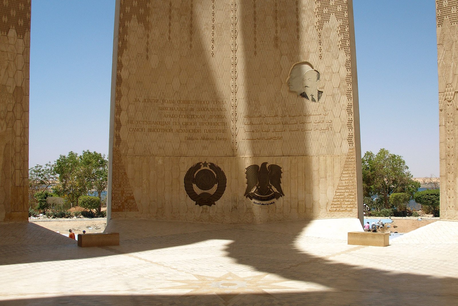
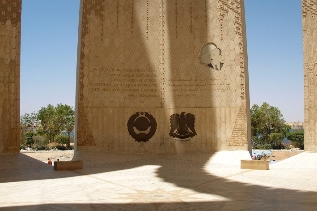
At the western end of the crest stands the Egyptian Soviet Friendship Monument, five concrete petals rising about 230 feet (70 meters) in the shape of an open lotus, a symbol that goes back to pharaonic times. This is where the vehicles stop, where the viewing platform is, and where nearly every photograph of a High Dam visit is taken.
Lake Nasser: a sea in the middle of the Sahara
Lake Nasser stretches roughly 340 miles (550 km) south from the dam and across the Sudanese border, where its southern portion is called Lake Nubia. At its widest it is about 22 miles (35 km) across, its surface covers a little over 2,000 square miles (about 5,250 square km), roughly five sixths of it in Egypt, and it holds on the order of 130 cubic kilometers of water. From the crest road you see only the first few miles, and it already looks like the sea.
A lake that size in one of the driest places on earth has consequences the planners underestimated. Evaporation removes a huge volume of water every year, and the immediate area has a slightly more humid microclimate than the desert around it. The lake has its own fishing industry and its own wildlife: the Nile crocodile, gone from the river north of the dam, survives in numbers here, which is why your cruise between Aswan and Luxor is crocodile free. A few boats sail the lake to Abu Simbel, calling at the rescued temples along the shore; ask us about that when you write.
Nubia under the water, and the UNESCO rescue of the temples
The lake did not fill empty desert. Lower Nubia, the valley between Aswan and the Sudanese frontier, had been inhabited for thousands of years and was dotted with villages, palm groves and temples. All of it went under. Around 50,000 Egyptian Nubians were moved north to new settlements around Kom Ombo, an area known as New Nubia, and a similar number of Sudanese Nubians were resettled far to the east. The families you meet in the painted houses of the Nubian village in Aswan are the descendants of that displacement, and their grandparents still talk about the drowned villages.
The monuments got an international campaign. In 1960 UNESCO launched an appeal, and over the next two decades more than twenty temples and shrines were surveyed, dismantled and moved. The two famous cases:
- Abu Simbel. Between 1964 and 1968 the two rock cut temples of Ramesses II were sawn into more than a thousand blocks, hauled up the cliff and reassembled about 200 feet (65 meters) higher inside concrete domes disguised as the original mountain. Our guide to visiting Abu Simbel from Aswan covers the practical side.
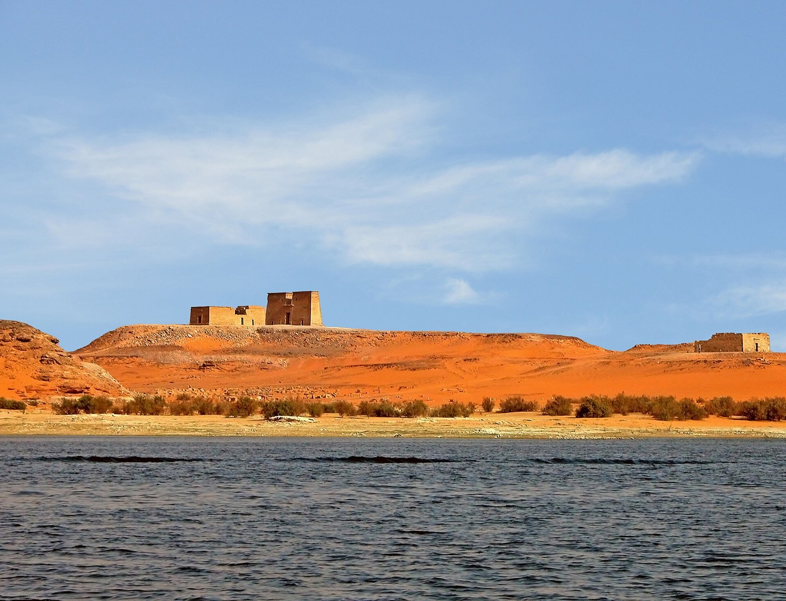
- Philae. The island of Isis was already flooded for part of every year by the old dam, and the High Dam would have drowned it permanently. From 1972 to 1980 the temples were taken apart and rebuilt on the neighboring island of Agilkia, reshaped to match the original. The boat to Philae temple leaves from a landing just below the High Dam, which is why the two visits are always paired.
Other temples were regrouped on the lake shore at Kalabsha, Wadi el Sebua and Amada, and four went abroad as thanks, including Dendur, now at the Met in New York, and Debod in Madrid.
What the dam changed: floods, silt, the Delta and electricity
The High Dam is still argued about in Egypt, and the stop makes more sense if you hold both sides in your head at once.
| What Egypt gained | What it cost |
|---|---|
| Complete control of the flood: no destructive high years, no famine low years. The drought of the 1980s that devastated Sudan and Ethiopia passed Egypt by. | The silt. For millennia the flood spread fertile mud over the fields each year. It now settles in Lake Nasser, and farmers rely on chemical fertilizer instead. |
| Year round irrigation, two or three harvests a year where there used to be one, and new land under cultivation. | The Delta coast. With no sediment arriving, the shore near Rosetta and Damietta erodes and salt water pushes into the low northern fields. |
| Large scale hydroelectricity at the moment Egypt was industrializing, and power for villages that had never had it. | Water lost to evaporation, and a sardine fishery off the Delta that collapsed when the nutrients stopped arriving. |
| A reliable river for navigation, which is what makes a scheduled Nile cruise possible at all. | The displacement of Nubian communities, and the drowning of every monument that was not moved. |
Neither column erases the other. The Egypt of 100 million people exists because of this dam, and the losses were real.
What you actually see on the visit
Set your expectations correctly, because this is the stop on the Aswan circuit that disappoints people hoping for a spectacle. What there is:
- The checkpoint. The dam is strategic infrastructure, so you pass an access control at the approach. Your guide handles it.
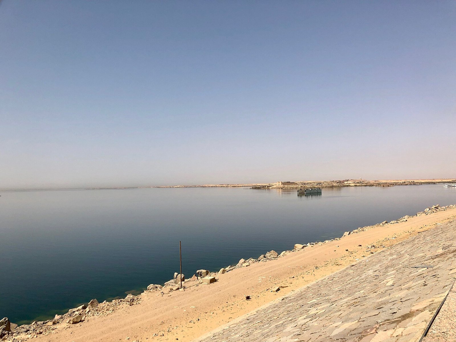
- The crest road. A wide, straight highway running the length of the dam. To the south the lake fills the horizon. To the north the ground drops away and the Nile reappears far below, winding between granite islands toward the old dam and Aswan.
- The lotus monument and viewing platform. The vehicle parks at the western end. You walk to the platform, look down the length of the dam, over the lake and back down the river, and read the panels about the construction.
- The powerhouse and the old dam. The powerhouse is seen from a distance on the eastern side; the old dam you cross or skirt on the drive to Philae's landing, and the difference in scale is obvious.
The value of the stop is understanding, not scenery. You are standing on the thing that ended five thousand years of Nile floods, and once you know that, the rest of Egypt reads differently.
How long it takes, and why it sits between Philae and the obelisk
Plan 20 to 30 minutes at the dam, plus about 25 minutes of driving from central Aswan. The three classic Aswan sights line up along the same road south of town, so the natural order on a morning is:
- The Unfinished Obelisk in the granite quarries on the edge of town, first, while the air is cool. Our guide to the Unfinished Obelisk in Aswan explains what you are looking at.
- The High Dam, a short drive further south, for the lake view and the monument.
- Philae, doubling back a few minutes to the boat landing below the old dam and crossing to Agilkia island, where you spend an hour or more.
Some guides swap steps two and three depending on the boat queue. Either way the dam is the short middle stop, and the whole loop takes three and a half to four hours before lunch, on a cruise or on a land tour alike. Our overview of what to see in Aswan shows how it all fits together.
Photography and the rules at the dam
Because the dam is a security site, photography is restricted, and the guards at the checkpoint and on the crest enforce it. In general terms:
- Photographs from the viewing platform of the lake, the river and the monument are normally fine, and this is where everyone takes theirs.
- Photographing the powerhouse, the spillway gates, the military posts and the checkpoint is not allowed. Do not point a camera at anything with a uniform near it.
- Drones are not permitted here or anywhere else in Egypt without a license, and nobody stops on the crest road to shoot from the window.
The rules can change, so listen to your guide on the day. Shoot at the platform, put the camera away on the road, and never argue with a soldier over a photo.
What a guide adds to a 20 minute stop
Quite a lot, because there is little to read on site and the interest is in the story. A guide who grew up in Aswan gives you:
- The context in the car on the way out: the flood, the famine years, the Suez Crisis, why the Russians and not the Americans built it.
- The Nubian side, often from family memory, including where the drowned villages were and where the families went.
- The temple rescue told in the right order, so that Philae half an hour later makes sense as a moved building.
- Handling of the checkpoint, the parking and the photo rules, which keeps the stop at 20 minutes instead of 45.
Without that, you get a wide road, a big lake and a concrete flower. With it, the hinge between ancient and modern Egypt.
How Explora Egipto slots the High Dam into your trip
We are a local agency in Egypt with our own guides and vehicles, and the High Dam is on every Aswan program we run:
- On a Nile cruise. The dam, Philae and the obelisk form the standard Aswan morning of any Nile cruise between Luxor and Aswan, with our guide meeting you at the boat.
- On a land tour of Aswan. Same loop in a private vehicle at your own pace, usually with a felucca sail and the Nubian village in the afternoon. See our menu of Aswan excursions.
- Combined with Abu Simbel. We place the dam and Philae on the day before the road trip, so the rescue story is fresh when you stand under the colossi.
The best months are October to April, when Aswan mornings sit in the 70s Fahrenheit (low to mid 20s Celsius). In summer the south passes 104 F (40 C) by midday, so we run the loop early. Tell us your dates and whether you are cruising or on land, and we send you the quote with the dam built into the right morning.
Frequently asked questions
Is the Aswan High Dam worth visiting?
Yes, as a short stop, not as a destination. The visit takes 20 to 30 minutes, the view over Lake Nasser is genuinely impressive, and the story of the flood, the Soviet construction and the temple rescue is the key that unlocks Philae and Abu Simbel. Go expecting a viewpoint and a history lesson rather than a spectacle.
What is the difference between the High Dam and the old Aswan Dam?
The old Aswan Dam is the British masonry dam of 1902 at the First Cataract, about 4 miles (6 km) downstream, which only tamed the flood peak. The High Dam is the 1960s Soviet backed embankment 8 miles south of town that stores years of water and created Lake Nasser. The High Dam is the one with the crest road and the lotus monument.
How big is Lake Nasser?
Roughly 340 miles (550 km) long from the dam into Sudan, up to 22 miles (35 km) wide, with a surface of a little over 2,000 square miles (about 5,250 square km). Most of it lies in Egypt; the Sudanese part is called Lake Nubia. From the dam you see only the first stretch, which already reaches the horizon.
Why were Abu Simbel and Philae moved?
Because the rising lake would have drowned them. UNESCO led an international campaign from 1960 that dismantled more than twenty Nubian monuments and rebuilt them on higher ground. Abu Simbel was cut into blocks and raised about 200 feet up the cliff between 1964 and 1968; Philae was moved to Agilkia island between 1972 and 1980.
Can I take photos at the Aswan High Dam?
At the viewing platform by the lotus monument, normally yes, of the lake, the river and the monument itself. Photographing the powerhouse, the spillway, the checkpoint or any military post is not allowed, and drones are banned. The rules can change, so follow your guide on the day and keep the camera down while the vehicle is moving.
How long does the High Dam visit take and when should I go?
About 20 to 30 minutes on site, plus 25 minutes of driving from central Aswan. It is the middle stop of the Aswan morning with the Unfinished Obelisk and Philae, a loop of three and a half to four hours. October to April is the comfortable season; in summer we run it early, before the heat climbs past 104 F (40 C).
Stand on the dam that changed the Nile, then see the temples it moved
Tell us your dates and whether you arrive in Aswan by cruise, train or domestic flight, and we come back with the Aswan morning in the right order, the High Dam, Philae and the obelisk with our own guide and vehicle, and the rest of your Egypt trip around it. No prices on this page, just a quote in your inbox.